11 Best Hikes in Maui (Easy to Strenuous Maui Hiking Trails + Map!)
The best hikes in Maui are diverse, from waterfall hikes and coastal walks to crater hikes and rainforest hikes.
If you are planning a trip to the Hawaiian paradise of Maui, you will definitely want to add some of these Maui hikes to your itinerary for the island.
Several of these hikes in Maui are part of Haleakala National Park, so plan on spending at least one full day in each of the two districts into which the park is split: the Summit District and the Kipahulu District.
The Sliding Sands Trail, which lets you explore the massive Haleakala crater, and the Pipiwai Trail, which leads through an otherworldly bamboo forest to a stunning waterfall, are two of the very best hikes in Maui.
In this article, we’ve rounded up the top hiking trails in Maui, from easy to strenuous. We hope our list inspires you to choose a few Maui trails for your next trip to the island!
Ready? Let’s get started discovering the top Maui hiking trails!
Hey, by the way! Snorkeling is probably at the top of your Maui itinerary — check out our guides to the best tours to Molokini Crater and Turtle Town, two of the top snorkel spots on Maui!
Some links on this page may be affiliate links. If you click an affiliate link and make a purchase, we may receive a small commission, at no extra cost to you. For more details, refer to our disclosure.
The Best Maui Hikes
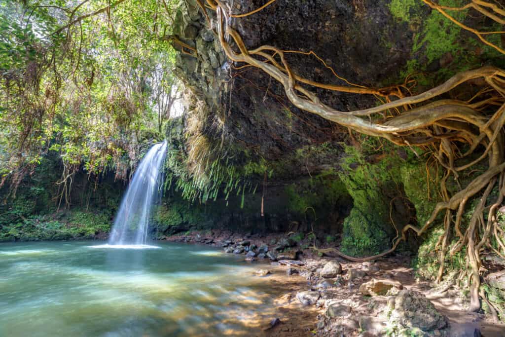
1. Twin Falls Trail
Length: 1.8 miles roundtrip, out and back
Elevation: 350 feet
Difficulty: Easy to Moderate
Trailhead: Access road near the fruit stand (see map)
The Twin Falls Trail is located on the property of Wailele Farm along the famous Road to Hana.
This trail is one of the best hikes in Maui, especially if you love chasing waterfalls!
Featuring the first waterfalls along the famous route, the Twin Falls Hike is hugely popular, and arriving early in key.
The trail is wide and well-maintained gravel, with lush tropical vegetation on both sides.
The Lower Twin Falls are pretty close to the parking area (about 0.2 mile) and you can view them from an overlook.
The spur to get down to this first waterfall is steep and often slippery so we suggest skipping it.
Keep walking along the main trail, and you’ll come to a stream crossing and your feet may get wet, based on the water level.

The trail continues through the jungle, past a second stream crossing, before you arrive at the second waterfall, known as the Caveman Falls.
The picturesque waterfall tumbles into an inviting plunge pool, where you can cool off.
When you are ready, you can retrace your steps back to the parking area.
Allow about an hour to 90 minutes, depending on whether you swim.
There are limited parking spots at Twin Falls, and there is a $10.00 parking fee per vehicle. If you arrive when the lot is full, you will be turned away, so arrive early in the day or later in the afternoon.
Also note that some days of the month are blocked off for residents.
2. Iao Valley Hike: One of the Best Hikes in Maui for Families
Length: 0.6 mile, loop
Elevation: 200 feet
Difficulty: Easy
Trailhead: Iao Valley State Monument, just past park restroom (see map)
Officially the Iao Needle Lookout Trail and Ethnobotanical Loop, this easy trail is family friendly and very scenic!
The paved trail takes you over a bridge and up to a viewpoint from where you can gaze at the Iao Needle, or Kuka‘emoku. There are over a hundred steps on the way up.
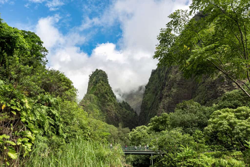
The needle rises up 1,200 feet from the floor of the valley, making for a stunning photo. Start early in the day for a lower likelihood of the needle being obstructed by clouds.
It still looks gorgeous when it’s misty or partially hidden by clouds, but you don’t want it to be completely socked in.
Iao valley is one of the wettest places in Hawaii and the vegetation surrounding the Iao Needle is lush and green. It is also a place that’s sacred to Hawaiians.
The trail also takes you through an area where you’ll see plant varieties cultivated by the Hawaiians that settled this area.

This ethnobotanical loop runs by the Iao stream.
Allow 45 minutes to one hour to do the walk and admire the views and the plants.
Good to know: The park is open from 7 a.m. to 6 p.m. daily.
Entry and parking reservations are required for non-residents of Hawaii. Entry fee is $5.00 per person and parking is $10.00 per vehicle.
>> Book these 5-star rated, highly popular, Maui Tours now!
3. Kuloa Point Trail
Length: 0.5 mile, loop
Elevation: 100 feet
Difficulty: Easy
Trailhead: Kipahulu District Visitor Center, Haleakala National Park (see map)
Located in the Kipahulu District of Haleakala National Park, the Kuloa Point Trail is a loop trail through native vegetation.
Going counterclockwise from the trailhead near the parking area, you’ll first come to an archaeological complex of sorts, where you can view thatched huts, ancient walls, and other remnants from the past.
From here the trail goes up a small hill, from the top of which you get beautiful views of the crashing waves and the ocean.
Also from here you can see the pools of O’heo Gulch, one of the top attractions along the Road to Hana. The Pipiwai Stream creates multiple waterfalls and pools before merging with the ocean.
You’ll then loop inland to return to the parking area. On the way look for the beautiful banyan tree!
Allow 30 minutes to one hour, depending on how often you stop.
Good to know: The gate of the parking lot at Kipahulu Visitor Center closes at 5 p.m. sharp, with last entry at 4.30 p.m.
There is a $30.00 fee per vehicle to enter Haleakala National Park, valid for three days, $25.00 for a motorcycle, and $15.00 for bike in or walk in.
If you have a National Parks Pass, you can use it at Haleakala National Park.
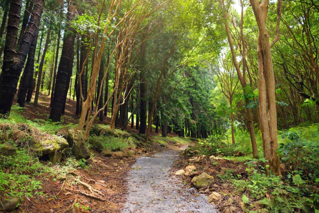
4. Hosmer Grove Trail
Length: 0.6 mile, loop
Elevation: 75 feet
Difficulty: Easy
Trailhead: Hosmer Grove Campground (see map)
Located inside the Summit District of Haleakala National Park, the stroll through Hosmer Grove offers a nice contrast to hiking the Martian landscape of the crater.
The easy loop trail takes you through a forest of introduced trees to native shrubland before returning you to the parking lot.
The introduced trees, like cedar, eucalyptus, pine, and spruce, were planted by Ralph Hosmer in the early 1900s to help prevent erosion after native forests were depleted.
Some of these species have become invasive and the park is trying to limit their growth.
There’s interpretive signage along the trail so you can learn as you walk.
As you walk through the grove, look for flowering plants like the hinahina (silver geranium), which is endemic to Haleakala — you won’t find it anywhere else on earth!
The Hosmer Grove Loop Trail is also an excellent place for birdwatching. Look for the brightly-colored endemic honeycreepers like the ‘i’wi and the ‘apapane.
Allow about 30-45 minutes.
Good to know: Haleakala National Park has an entrance fee: $30.00 per vehicle, $25.00 for a motorcycle, and $15.00 for bike in or walk in. The entrance is valid for three days.
If you have a National Parks Pass, you can use it at Haleakala National Park.
>> Book these 5-star rated, highly popular, Maui Tours now!
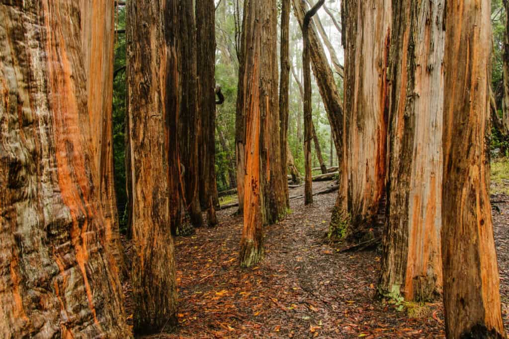
5. Waikamoi Ridge Trail
Length: 0.9 mile roundtrip, out and back
Elevation: 255 feet
Difficulty: Moderate
Trailhead: Just after mile marker 9 on the Hana Highway (see map)
A nature trail along the legendary Road to Hana perfect for stretching your legs, the Waikamoi Ridge Trail, located in the Waikamoi Preserve, is also known as the Waikamoi Nature Trail.

Park on the mountain side of the road and start the walk at the nearby trailhead. You’ll head into forest with both native and introduced trees, with occasional glimpses of the deep blue ocean.
Pass through a grove of paperbark trees: the bark peels off like paper, hence the name! You will also go through a grove of tall bamboo. Listen for the deep chime as the bamboo stalks brush up against each other.
Other trees you will likely see along the trail include the kukui nut tree, mango, and hala.
Look for the brightly colored heliconia flowers, gingers, lush green ferns, philodendrons with massive leaves, and other tropical plants as you make your way to the lone bench at the top of the trail. Here you can sit for a bit and admire the views!
Birdwatchers should bring their binoculars and try to spot the brightly-colored i’iwi, ‘apapane, or Hawaii amakihi. The sounds of birds chirping will likely accompany you on your walk!
Allow about 30-45 minutes.
Good to know: The Waikamoi Ridge Trail is one of the less well-known stops on the famous Road to Hana. Drive on your own to experience this wonderful trail.
6. Kapalua Coastal Trail
Length: 3.5 miles roundtrip, out and back
Elevation: Negligible
Difficulty: Easy
Trailhead: Kapalua Bay or D. T. Fleming Beach (see map)
A gorgeous walk along mixed terrain in northwestern Maui, the Kapalua Coastal Trail is a wonderful Maui hike for families.
While the full walk is about 1.76 miles each way, you can choose to walk a shorter portion of it if you have young kids or you are short on time.
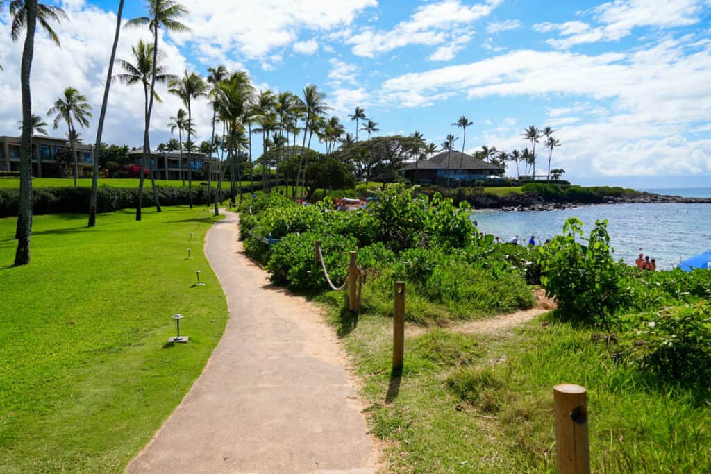
Running from the southern end of Kapalua Bay, the trail heads past the Ritz Carlton and the Montage Kapalua Bay before heading to D. T. Fleming Beach.
Part of the walk is paved, part is packed dirt, and some of it is wooden boards. Adventurous hikers can stop to explore tidepools in the rocks or even try some cliff jumping.
Along the route, you will be treated to superb ocean views at Kapalua Bay, Oneloa Bay, and Honokahua Bay. In the winter, look out into the ocean: you may see whales spouting or breaching.
Also along the way, be sure to take in the beauty of the unique Dragon’s Teeth rock formations, and stroll to Makaluapuna Point for the views and to admire the Kapalua Labyrinth.
And after the hike, you can relax at the beach at whichever end you finish! Kapalua Bay Beach and D. T. Fleming Beach are both wonderful family beaches.

There is beach parking at D. T. Fleming Beach and a beach access parking lot at Kapalua Bay Villas, but the trail and the beaches are popular so start early to nab a parking spot.
Allow about 2-3 hours, more if you want to swim, snorkel, or explore tidepools along the way.
>> Book these 5-star rated, highly popular, Maui Tours now!
7. Pa Ka’oao Trail
Length: 0.4 mile roundtrip, out and back
Elevation: 110 feet
Difficulty: Moderate
Trailhead: Haleakala Visitor Center, Summit District (see map)
The Pa Ka’oao Trail is located near the top of the Haleakala Crater. It’s a short but steep trail, perfect for even a brief visit to the summit.
The trail climbs up to the top of a cinder cone and offers fabulous views over the crater, and the peaks on the Big Island of Hawaii in the distance.
Although the trail is short, it does feature some steep steps and some rocky areas, so wear proper shoes and watch your step.
The top of the Pa Ka’oao Trail is a great place to catch sunrise if you did not get a parking spot at the very top of the crater. It’s also a great spot for sunset.
There is no shade on this trail so remember sun protection. The trail can also be very windy.
Allow about 30-45 minutes, more if you plan to watch sunrise or sunset.
Good to know: Haleakala National Park has an entrance fee: $30.00 per vehicle, $25.00 for a motorcycle, and $15.00 for bike in or walk in. The entrance is valid for three days.
If you have a National Parks Pass, you can use it at Haleakala National Park.
8. Pipiwai Trail
Length: 4 miles roundtrip, out and back
Elevation: 800 feet
Difficulty: Moderate
Trailhead: Haleakala Visitor Center, Summit District (see map)
Located in the Kipahulu District of Haleakala National Park, the Pipiwai Trail is one of the top hiking trails in Maui. It’s the perfect trail to get up close to the lush rainforest on the eastern coast of the island.
The hike ends at a viewing area for the spectacular 400-foot Waimoku Falls, which plunges down a lava cliff.
Along the Pipiwai Trail, look for other exciting sights such as a very large banyan tree with multiple trunks, the 200-foot Makahiku Falls, and a variety of tropical plants.
Perhaps the most popular part of the Pipiwai Trail is the boardwalk through a forest of towering bamboo. The half-mile section offers lots of photo ops and you must stop to hear the bamboo “chime” as the stalks hit one another in the breeze.

The Pipiwai Trail can be muddy and slippery, especially after rains, so wear proper footwear.
To access the Pipiwai Trail, and be able to hike it, you should plan to arrive at the Kipahulu Visitor Center by 2.30 p.m., since the gate to the parking lot closes at 5 p.m.
Preferably, spend a night in Hana and do the Pipiwai hike early in the day when it’s likely to be less crowded.
Allow about 3 hours.
Good to know: Haleakala National Park has an entrance fee: $30.00 per vehicle, $25.00 for a motorcycle, and $15.00 for bike in or walk in. The entrance is valid for three days.
If you have a National Parks Pass, you can use it at Haleakala National Park.
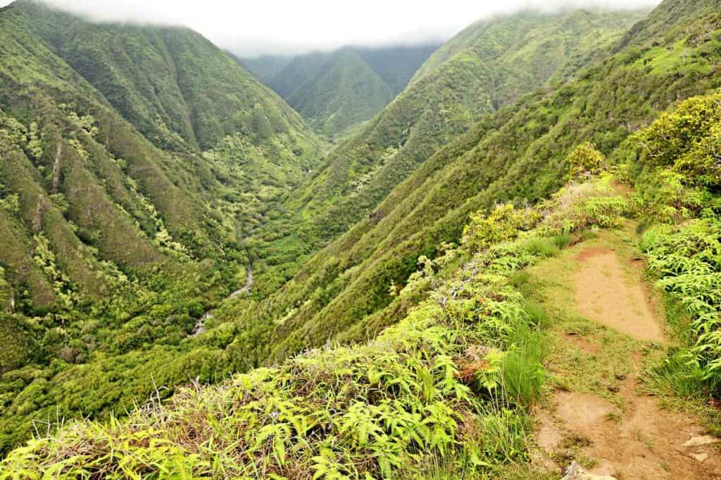
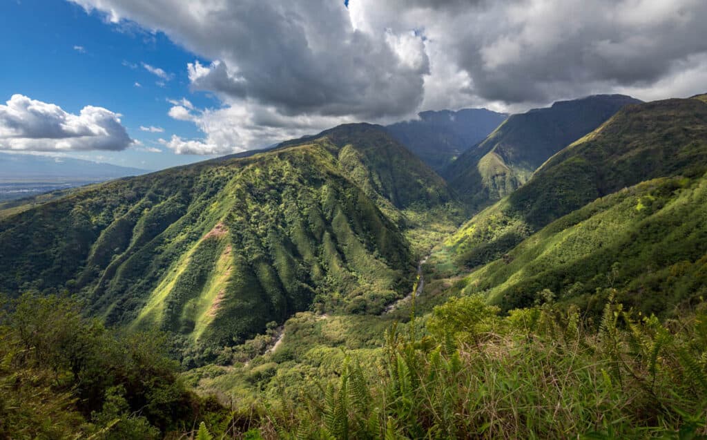
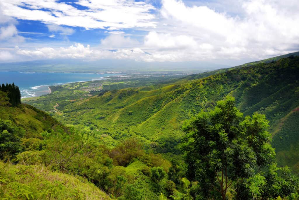
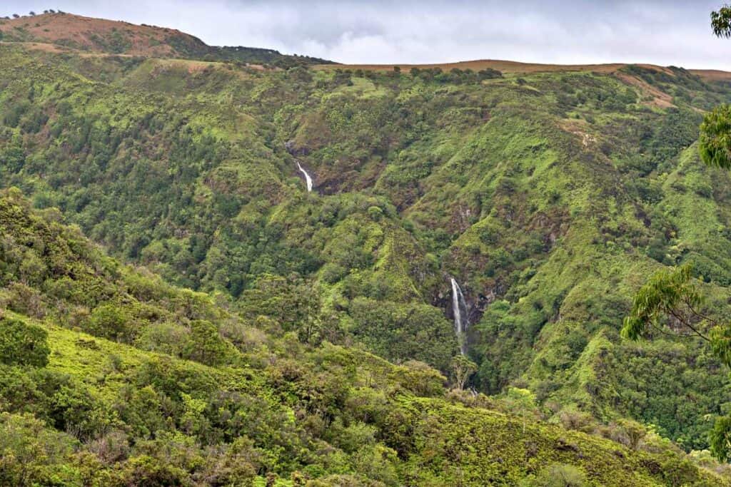
9. Waihe’e Ridge Trail
Length: 5 miles roundtrip, out and back
Elevation: 1,600 feet
Difficulty: Challenging
Trailhead: Maluhia Road (see map)
If you’re up for the challenge, the Waihe’e Ridge Trail in the West Maui Forest Reserve offers spectacular 360-degree views!
The first part of the trail is very steep pavement that gives way to a lovely forest, and offers a view of the stunning double-tiered Makamaka’ole Falls.
After the falls, you’ll come out of the trees and onto the ridge, with gorgeous views into the lush Waihe’e Valley, and behind you, the Pacific Ocean.
Keep climbing up the ridge until you arrive at the very top, where, on clear days, you get expansive views over the ocean and the Molokini Crater.
If you brought a snack to enjoy, there’s a picnic table at the top to have a bite with a view!
Plan to do the Waihe’e Ridge Trail in the morning for your best shot at unobstructed views. It’s also good to start early to be able to get a parking spot.
This isn’t a trail you want to hike when it’s just rained, because it gets very muddy and dangerously slippery. Wear proper hiking shoes with good grip. And you’ll want to bring a rain jacket, because the region is very rainy!
The Waihe’e Ridge Trail and the parking lot are open from 7 a.m. until 7 p.m. everyday.
There is an overflow parking lot if you arrive when the lot at the trailhead is full, but it adds some distance and elevation to the hike. Or you can wait for a spot to open up.
Allow about 3 to 4 hours.
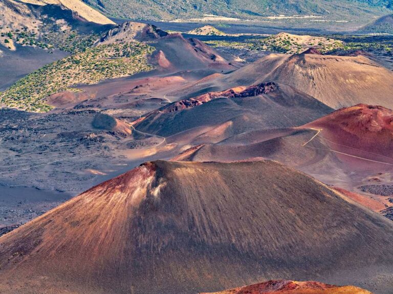
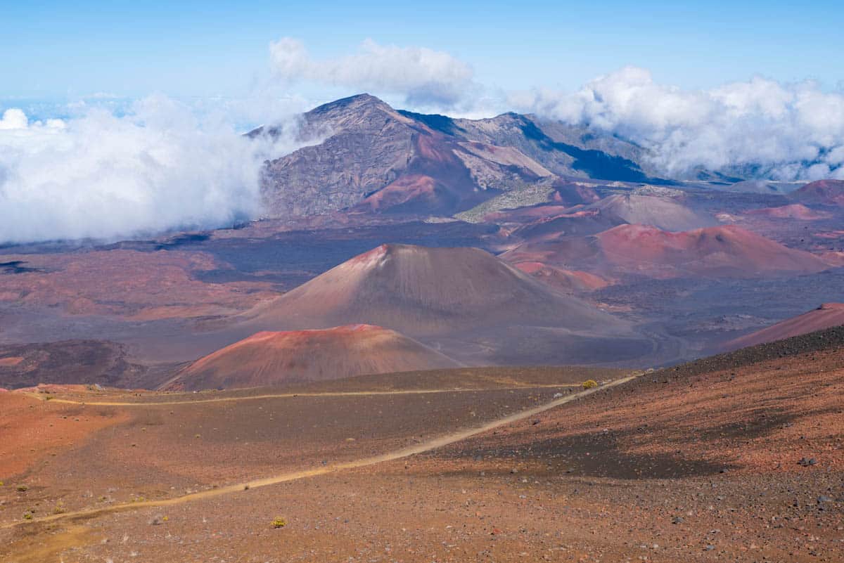
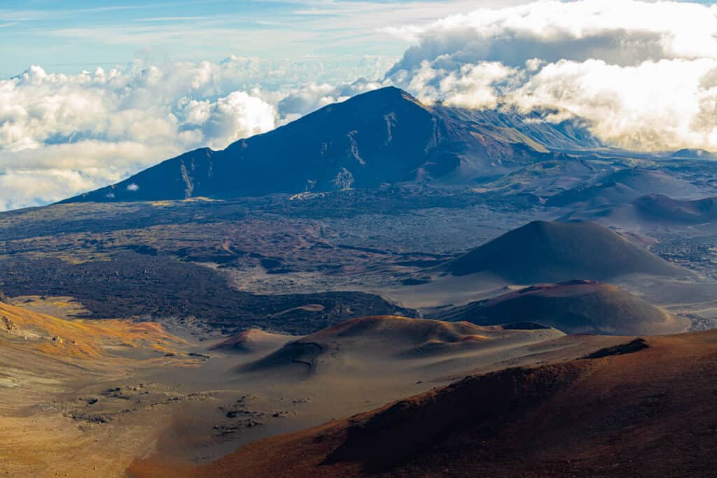
10. Sliding Sands to Halemau’u Trail
Length: 10.5 miles, point-to-point
Elevation: 2,275 feet
Difficulty: Challenging
Trailhead: Haleakala Visitor Center(see map)
The most popular trail in the Summit District of Haleakala National Park and one of the most iconic hikes in Hawaii, the Sliding Sands Trail is challenging but very rewarding!
The official name for the trail is the Keonehe’ehe’e Trail.
This trail takes you down into the Haleakala Crater, allowing you to experience the Mars-like landscape up close.
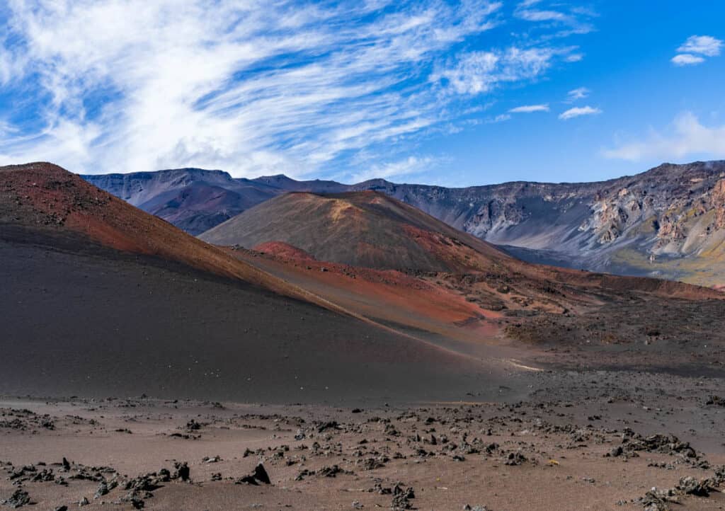
You will see cinder cones, the rare and endangered Haleakala silversword plant, Pele’s Paint Pot, and maybe even birds as you hike the trail.
You can hike 2.5 miles down to the Ka Lu’u o ka O’o cinder cone on the crater floor and back to the start point, for a total hike of 5 miles.
You can also hike the Sliding Sands as a full loop, a strenuous hike that’s a little over 11 miles. This will bring you back to the starting point.
And finally, you can hike the Sliding Sands Trail to the Halemau’u Trail, which is also about 11 miles. This option brings you out of the crater at a different spot, so you’ll need a ride back to the trailhead parking area.
Note that a reservation is required to park at the Summit District between 3 a.m. and 7 a.m. So if you plan to hike the trail during that time, and will arrive in your car, get a parking reservation in advance.
Good to know: Haleakala National Park has an entrance fee: $30.00 per vehicle, $25.00 for a motorcycle, and $15.00 for bike in or walk in. The entrance is valid for three days.
If you have a National Parks Pass, you can use it at Haleakala National Park.
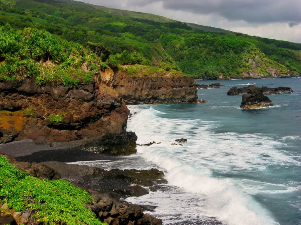
11. The King’s Trail East at Wai’anapanapa State Park
Length: About 5 miles roundtrip, out and back
Elevation: About 200 feet
Difficulty: Easy to Challenging (depending on how far you go)
Trailhead: Wai’anapanapa State Park paved lookout area(see map)
A section of the old Kings Highway goes through Wai’anapanapa State Park, and if you have the time, you can do this hike when you visit!
One section of the trail leads east towards Hana from the paved lookout area at the park. This trail offers beautiful ocean views, a view of an old Hawaiian cemetery, and a look at a blowhole that can be spectacular when active.
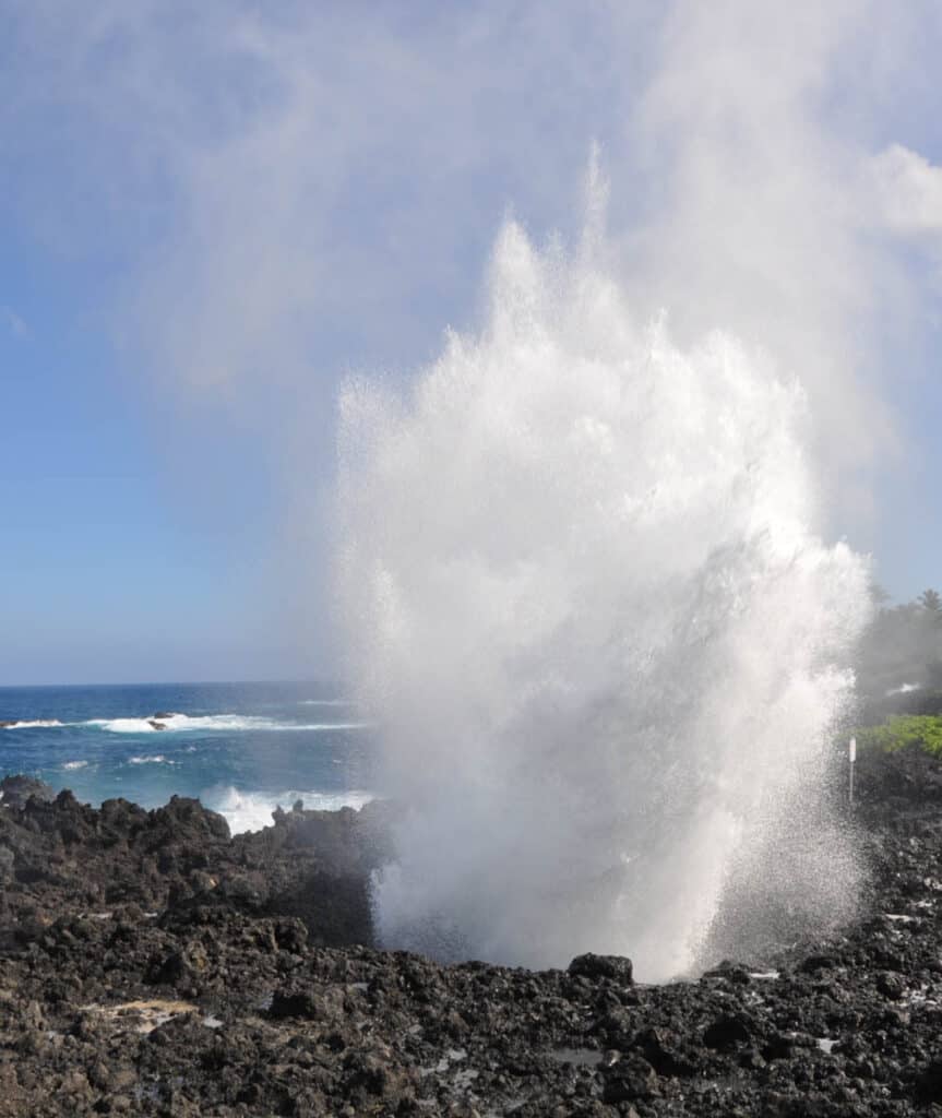
Continue south past the blowhole to pick up the trail: you can go as far as you want and then retrace your steps. The full hike is 5 miles round trip, out and back.
If you keep going, you will pass through a beautiful grove of native hala trees and then the signed Ohala Heiau, a sacred site.
After this point, the trail changes from easy to strenuous, and the trail itself becomes difficult to trace. The trail is very rocky, with exposed tree roots.
If you choose to go on, you will eventually come to the stunning Kainalimu Bay, and there is a path down to the bay if you want to go down.
Good to know: Advance entry and parking reservations are required for Wai’anapanapa State Park. Entry is $5.00 per person and parking is $10.00 per vehicle. Reserve here.
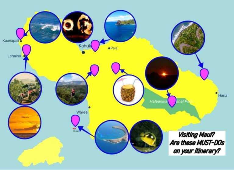
Map of Best Maui Hikes
Hiking Gear Checklist
Many of Hawaii’s hikes are demanding, make sure you are well equipped and well prepared. Here’s what we typically take with us:
- Water Bottle: I hate plastic bottles, and with opaque bladders you can’t see if it is moldy inside. We use this Hydro Flask water bottle – light, stainless steel, wide mouth (you can add ice), with double-wall vacuum insulation (greatly refreshing for hikes in summer). You can also get it with a Flex Straw Lid!
- Hiking Shoes: My preferred hiking shoes are the medium range Merrell Moab 3 Waterproof Hiking Shoe (men’s, women’s, men’s mid), great for Hawaii’s trails through mud and streams. My wife loves her high-end Salomon X Ultra 4 GTX Hiking shoes (men’s, women’s), also waterproof.
- Sunscreen: Hawaii’s sun can be harsh. Avoid sunburn with sunscreen compliant with Hawaii’s 104 Reef Act. The Sun Bum Original SPF 50 Sunscreen Spray, moisturizing with Vitamin E, is our go-to when we travel to Hawaii. Apply liberally and regularly!
- Trekking Poles: Great for hikes that involve climbing, both going uphill and downhill, and on trails that are wet, muddy and slippery! Improve your footing with this collapsible, high-end Black Diamond Trail Cork Trekking Poles, available for men and women.
- Headlamp: Planning a sunrise or sunset hike? Hiking in the dark is no fun, especially on many of Hawaii’s rainforest or ridge hikes. We love these two headlamps: the budget Black Diamond Spot 400 Headlamp and the premium Petzl Actik Core Headlamp, with many features.
The Best Maui Tours
Have you booked these top-rated Maui guided adventures yet?
Small-group Road to Hana tour so everyone in your group can sit back and enjoy the views without worrying about negotiating hairpin bends or finding parking at popular stops!
A Haleakala sunrise tour so you can experience the bucket-list sunrise atop the volcano without the need to reserve a parking spot or drive up in the dark!
A Maui whale watching raft tour, which will let you see the massive humpback whales at eye level! (You can also opt for a more sedate boat whale watching tour.) A MUST winter Maui activity!
A Maui snorkeling excursion that combines the Molokini Crater with Turtle Town, the two most epic snorkeling destinations on the island!
A 7-line Maui zipline experience where you can glide over the forests on the north shore of Maui. Enjoy ocean views and navigate obstacle course challenges!
An oceanfront luau in Wailea where you can enjoy a sunset buffet and traditional Polynesian entertainment. You can also opt for a Kaanapali oceanfront luau.
Renting a Car in Maui
The best things to do in Maui are located all over the island.
Public transport options on Maui are minimal to non-existent, so if you want to explore the island beyond your base, you’ll want to book a rental car for your Maui trip.
We always use Discover Cars to book Maui car rentals. They search across a variety of rental car companies, both budget and brand, to offer you the best deals, AND they offer free cancellations. Plus, there are no hidden fees.
>> Check availability and prices on Maui car rentals now!
Where to Stay in Maui
Depending on whether you want a vacation rental with more room and the option to cook some of your meals, or you want a resort or hotel experience, and depending on which part of Maui you want to choose as your base, you have a variety of options.
By far the majority of visitors to Maui choose to base on the west side, where there is a large selection of accommodations available, from resorts and hotels to vacation rentals.
We suggest starting your search for Maui accommodations by browsing vacation rentals on VRBO. You can filter to choose a specific area, such as Kihei, Kapalua, or Wailea.
We have stayed in VRBO rentals in Kihei and Kapalua and find that the choice and quality are generally great.
>> Look for a Maui vacation rental on VRBO now!
More Maui Travel Inspiration
If you are considering a trip to Maui, read some of our other comprehensive guides to craft the ultimate Maui itinerary!
If you are a first-time visitor to Maui, start by reading our article on the best things to do in Maui. From beautiful beaches and lush rainforest to Maui’s volcanic crater, our round-up captures the most iconic Maui experiences and activities.
If you are dreaming of a winter getaway to a tropical paradise, read our guide on why you should visit Maui in winter!
If you are planning a brief first visit to Maui, here’s our 3-day Maui itinerary to help you flesh out your own trip! And if you are considering a couples getaway to Maui, read about the top romantic things to do in Maui!
Driving the Road to Hana is one of Maui’s bucket-list experiences. We have a comprehensive guide to the best stops on the Road to Hana, including waterfalls and short hikes on the way.
One of the top stops on the route is Wai’anapanapa State Park, which requires reservations. Read our full guide to Maui’s black sand beach in this popular state park!
Maui boasts one of only two national parks in Hawaii. Read our round-up of the best things to do in Haleakala National Park. We also have the ultimate guide to sunrise at Haleakala.
We also have a guide to the best hikes in Haleakala National Park, and in-depth hiking guides to the two most epic hikes in the park: the Sliding Sands Trail and the Pipiwai Trail.
Speaking of hiking, also be sure to check out our round-up of the best Maui hikes, from easy to challenging. Plus, peruse our complete guides to hiking the popular Kapalua Coastal Trail in northwest Maui, and the Waihee Ridge Trail for astounding views!
We also have a round-up of the best waterfalls in Maui, from the 400-foot Waimoku Falls to Upper Waikani Falls near Hana. Some Maui waterfalls can be seen from viewpoints whereas others require hiking.
Water activities are plentiful in Maui! Check out our epic guide to whale watching in Maui, and our guide to the best Molokini snorkeling tours and the best Turtle Town snorkeling.
If you’d rather snorkel from shore, read our round-up of the best snorkel spots in West Maui.
Every Maui itinerary should have plenty of beach time: there are so many beautiful beaches in Maui that you are spoiled for choice. We have a round-up of the best beaches in South Maui, plus a detailed guide to Wailea Beach in southwest Maui, and one for Maluaka Beach along the Turtle Town stretch of coast.
We also have articles on the much-visited Kaanapali Beach, the popular Napili Beach and local favorite Keawakapu Beach. Along the northwest side, Honolua Bay is a famous surfing spot, and Ho’okipa Beach, near Paia, is a windsurfing mecca.
If you are looking to experience a different side of Maui, plan a visit to the Iao Valley State Monument. The lush landscapes and serene ambience will wow you! Also read our guide to Maui’s state parks, which include popular Makena State Park, home to Big Beach and Little Beach.
Spend a day exploring Upcountry Maui. Some of the best things to do in Upcountry Maui include touring farms and gardens. Help milk goats, tour a tea farm, go wine tasting and much more.
Did you find this article informative? Pin it for later!

Disclaimer
All information provided on this blog is for informational purposes only and is subject to our terms and conditions of use. It is not a substitute for information or advice from official agencies or qualified professionals.
SV Travel Media LLC makes no representations or warranties regarding the accuracy or completeness of the information provided here, and readers should use their own discretion and judgement, and seek advice from professionals where needed.
Your use of the information described in, and your participation in activities presented on our website may carry the risk of illness, bodily injury, disability, death, or property damage. You freely assume all risks and dangers that may occur as a result of your access, use, purchase, or participation in any information, activity, product, or service listed on our website.